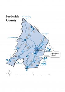
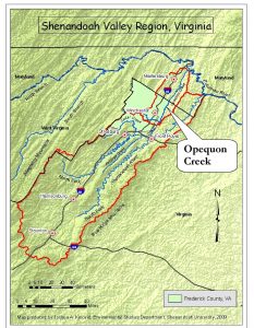
Opequon Creek runs about 35 miles to the north-northeast from Frederick County, Virginia to its mouth on the Potomac River northeast of Martinsburg, West Virginia.
In Virginia, the creek forms a natural boundary between Frederick County to the west and Clarke County to the east, and in West Virginia it forms the southern half of the boundary between Berkeley and Jefferson Counties. Among Opequon Creek’s principal tributaries in Virginia are Abrams Creek, Redbud Run, and Hiatt and Lick Runs.
Public access is available to several portions of Abrams Creek and Redbud Run. (See links for descriptions and directions.) There are no developed, public access points to Opequon Creek in Virginia. Opportunities for fishing and small-boat access are available along the Opequon in West Virginia.
In both Virginia and West Virginia, Opequon Creek has been identified as having impaired water quality. Plans to improve its water quality [called Total Maximum Daily Load (TMDL) Implementation Plans] have been developed, and implementation of several measures is underway.
Directions:
See links for Abrams Creek Wetlands Preserve, Jim Barnett Park, Redbud Run Greenway, and Third Winchester Battlefield for public access along Abrams Creek and Redbud Run.


