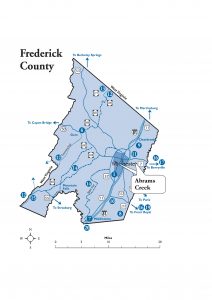
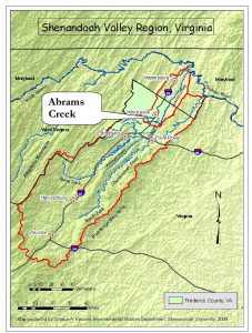
Abrams Creek and its principal tributary, Town Run, are located in northwestern Virginia’s Shenandoah Valley region (although not within the Shenandoah River’s watershed).
Land comprising the Abrams Creek watershed is contained entirely within Frederick County and the City of Winchester, Virginia. In turn, Abrams Creek makes up the southwestern portion of the Opequon Creek watershed, which flows northward and enters the Potomac River north of Shepherdstown, West Virginia.
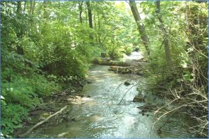
In its winding 10.8-mile path from Round Hill to Opequon Creek, Abrams Creek presents many types of stream environments. Slow sections meander through farmland, while other stretches run next to railroad tracks, through the Shenandoah University campus, and beside residential areas. There are also riffle-and-pool zones beneath high shale banks, portions jacketed with riprap, straightened areas with grassy banks mowed to the water’s edge, and landscaped sections adjacent to some of Winchester’s busiest highway junctions.
Near its headwaters and straddling the Winchester-Frederick County boundary lies the Abrams Creek Wetlands. Despite adjacent development, these marshes and swamps are one of the valley’s most important natural areas. They are home to over 180 bird species and 20 plants on Virginia’s Rare Plants List. The City of Winchester manages the 25-acre Abrams Creek Wetlands Preserve here.
Directions to the Abrams Creek Wetlands Preserve:
From Route 11 a mile south of downtown Winchester, turn right (west) onto Jubal Early Drive. In 0.2 miles, park at the Abrams Crossing commercial center on the left. Follow the paved path beside the swamp and then into the marsh.


